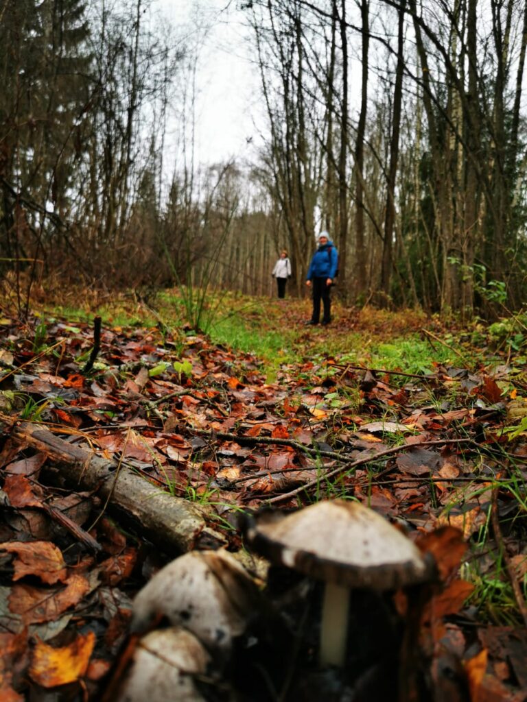
A 70-kilometer hiking trail has been created from Subate to Nereta. Along the ridges of oak trees, forest roads and natural entrances, through small towns and along scattered villages, meadows, marsh edges and the coast of the South Susēja. Most of the sections can also be ridden by bicycle.
In 2024, we conducted a survey and marking of the scenic hiking section SUBATE-GĀRSENE. The marking was created using the Forest Trail guidelines and colors – yellow and white. The length of the trail is about 17 kilometers. Marking and other works were carried out in cooperation with the local nature tourism community and the Gārsene and Subate parish administrations.
The remaining sections are awaiting marking. The route is currently being coordinated with all parties involved. GPX files are available for all sections.
Route SUBATE-GĀRSENE, approx. 17 km
The section starts in the historical center of Subate and leads along the tree alley past the health and social care center “Subate”. Behind it, you have to cross the P70 Svente-Lithuanian border. Further, the route leads along a gravel road, on the right side you can see a large cross for Latvian and Lithuanian forest brothers. The route goes straight until the gravel road turns sharply to the right – the Leišmalīte section leads across a field straight to the forest. When entering the forest, you must cross a large drainage ditch over a culvert, which is marked on maps as Dienvidsusēja.
The route then leads through the forest to a clearing with planted pine trees. There you can see the remains of an old house. From the dwelling, turn left towards the Lithuanian border, walking along the edge of the forest past the hunter’s tower until you cross the Melnupe River. A passage has been created from trees to cross the watercourse, which at times may be under water. Then walk through the forest again to the young forest. In the young forest, the route leads along a created path along the right edge. When the path ends, turn left. The walk takes place along the state border, which is formed by the Dienvidsusēja River. After a couple of kilometers, turn left into a forty-year-old spruce forest. There, the trail crosses the border of Subate and Gārsene parishes. When you leave the spruce forest, there is a State Forest Road roundabout in front of you, which is already in Gārsene parish. Continue for about 1.5 kilometers, then turn right onto the forest road. The further path leads along the back of a ridge (osa). To the left, below, is Dienvidsusēja, to the right – Baltmuiža bog.
The road gradually becomes less important, leading into a spruce forest all the way to the ravine. This is the Lāčupe, which flows from the swamp to Dienvidsusēja. Then the route leads into an older mixed tree forest. This trail leads past the Kurmišķi hillfort. Further on, the forest becomes younger: 10-15 year old birches, newly planted spruces, and then an overgrown meadow with an old tractor tire. At the tire, you need to turn slightly to the right. The route includes white alders, spruces, some birches, tractor ruts in places, and large puddles. On the right side of the recently planted forest is an old house, next to it are large trees. Behind them, you need to turn slightly to the left. On the left side is a young spruce stand, on the right is an older tree stand. Further, the route leads along the municipal road. On the left side of the road is a sunken bathhouse and an uninhabited house. Continue along the farmsteads, one of which passes through a courtyard crossed by the road. Further on, you can see the tower of the Gārsene Lutheran Church, on the right side of the road is the Gārsene cemetery, after it you have to turn onto the paved road, crossing the bridge over the floodplain of the South Susēja until you reach Gārsene Castle – the end of the route.
WELCOME:
Getting between the route points:
Intercity bus on the section Gārsene-Subate
Every day
8:01-8:30 route Aknīste-Gārsene-Subate-Ilūkste-Daugavpils
Intercity bus on the section Subate-Gārsene
Every day
17:07-17:27 route Daugavpils-Ilūkste-Subate-Gārsene-Aknīste
Where to eat:
by prior arrangement, z/s “Rātes”, “Labieši”, Gārsene; GPS 56.0994, 25.8098, tel. + 371 27872199
Shops in Gārsene and Subate:
IU Sūknis, “Akācijas”, Gārsene; GPS 56.101135, 25.809762.
Mini Vesko, “Gāršas”, Gārsene parish; GPS 56.101837, 25.820953.
mini TOP, Market Square 22, Subate; GPS 56.003318, 25.906938.
Where to stay:
Gārsene Castle, “Labieši”, Gārsene; GPS: 56.0994, 25.8098, phone: + 371 26367150, www.garsenespils.lv
Sightseeing
Gārsene nature trails. Guides – tel. + 371 26367150 or +371 29 441 918
Active recreation in Gārsene and Subate (boats, SUP, bicycles), tel. +37120034392, www.selijaslaivas.lv
Active recreation in Subate (SUP, catamarans, boats), tel. +371 27150854
Wine tasting in Gārsene, tel. +371 29 441 918
Antique collection “Solis sendēnaos” in Gārsene, tel. +37126430814
Wellness in Subate (bathhouse services), tel. +371 29184640
Subate sightseeing, tel. +371 29184640 or +371 27150854
Route GĀRSENE-AKNĪSTE, approx. 13 km
The route leads along local gravel roads with low traffic density. Landscape of cultivated fields, forests and scattered villages typical of the region. The route is suitable for cycling.

Photo by I.Mieze
Route AKNĪSTE-SKĀRDUPĪTES, approx. 9 km
The route offers enchanting views of the Dienvidsusēja floodplain and valley. The route crosses floodplain meadows. They may be flooded during the flood season. Arrival point at the historical center “Skārdupītes” – tent sites are available. There is a bus stop nearby. The route is also suitable for cyclists.
SERVICES AVAILABLE IN AKNISTE:
• Bus station at Augšzemes Street 16. Three times a day, a bus leaves for the start of the route in Subate. Once a day you can get to the end of the route in Nereta.
• Cafe “Kalniņā”, hotel and SPA and fitness room, Skolas iela 5
• Hotel “Liepas”, Augšzemes iela 68
• Shop “Top!”, Augšzemes iela 17
• Shop “LATS”, Skolas iela 12
• Veikals “Vesko”, Skolas iela 5
• 24-hour gas station “Astarte”, Augšzemes iela 60
• Pharmacy, Skolas iela 9
• Swedbank ATM, Skolas iela 7
• DPD, Venipak and Posta parcel machines, Augšzemes iela 17
• Omniva parcel machine, Skolas iela 7
• Library and local history museum, Skolas iela 16A, city tours during working hours, phone charging and drinking water.
•City government with a customer service center, Skolas Street 7 – phone charging and drinking water during working hours.
VISIT OBJECTS
• Sēļu park with smart bench – phone charging.
• Multifunctional square with public toilet, water intake point.
• Saltupju Svētavots – spring water. Drink only fresh, as it creates sediment in bottles.
• Cable bridge over Dienvidsusēja. Attention – the route is close to private property. There may be dogs!
Photo by I.Mieze
Route SKĀRDUPĪTES-ELKŠŅI, approx. 9 km
The route leads through meadows and forest roads. At Apserde, you need to cross the regional road P73. The route then leads along scenic forest paths to Elkšņi. The end of the route section is at the tourist object: “Alīdas kafeja” factory.
AVAILABLE SERVICES:
• Coffee factory “Alīdas kafeja”, “Dzelmītes”, Elkšņi – excursions, catering, drinking water, phone charging, bicycle rental.
• Accommodation Elkšņi in Elkšņi centre – drinking water, phone charging.
• Library and parish office in Elkšņi centre – drinking water, phone charging during working hours.
• Bus stop
Photo by I.Mieze
Route ELKŠŅI- CĪRUĻI, approx. 6 km
The route leads along less active but scenic gravel roads. At the end of the route near Dienvidsusēja there are tent sites with a sauna on the banks of the river. A campfire site and tables. The route section is also suitable for cyclists.
AVAILABLE SERVICES:
• Drinking water, dry firewood, and phone charging are available at the house “Lazdiņas”, Rite parish.
• LATS store “Druviņas 5”, Cīruļi, approximately one kilometer from the tent site
• Library with a customer service center, Skolas Street, Cīruļi – drinking water, phone charging during working hours.
• Bus stops approximately two kilometers from the tent sites.
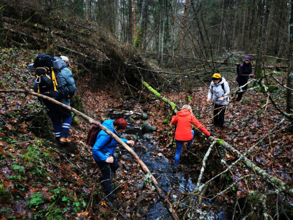
Photo by I.Mieze
Route CĪRUĻI – NERETA, approx. 16 km
The route leads along inactive but scenic gravel roads to the border of Nereta parish, where the roads turn into trails or natural entrances. On the banks of Dienvidsusēja there is a rest area with “Pie senā autobusa” – tent sites, drinking water, phone charging.
Natural entrances turn into inactive gravel roads until crossing the regional road P73. Getting to Nereta is via a relatively dense local traffic road. The route section is also suitable for cyclists.
AVAILABLE SERVICES:
A wide range of services is available in Nereta. One of the main ones is the bus station at Dzirnavu Street 5. From there, a bus leaves twice a day to the starting point of the hike – Subate. Phone charging and drinking water are available at the bus station.
• Aibe store, Raina street 15
• Top! Store, Raina street 6
• Swedbank ATM, Raina street 6
• Pharmacy, Raina street 9
• Electric car charging point, Pētera Lodziņa street 2B
• Omniva, DPD, Venipak parcel machines, Raina street 6
• 24-hour gas station, Rūpniecības street 5
• Parish office with a unified customer service center, Rīgas street 1
• Public swimming pool “Pie pūcītes”
TOURISTIC ACTIVITIES:
• Zanda Ragele’s ceramics workshop, “Kalna Gribacānis” in Nereta parish
• Glamping “Debessjums” and alpaca therapy, “Purenes”, Nereta
VISIT OBJECTS:
• Nereta hydroelectric power plant (HES)
• Nereta Evangelical Lutheran Church. Guided tour also available. Rīgas Street 2.
• Jāņa Jaunsudrabiņa Park with Sēlija’s Flag
OTHER SERVICES:
• Aija Jakubene makes cards, envelopes, boxes, place cards, invitations, + 371 29428634.
• Evita Vīnakalne makes cups, mugs, spoons, jars, magnets with polymer clay decorations, + 371 26490043.
• Krustakroga dārzniecība offers annual, biennial and perennial flower seedlings. Gift cards are also available. Information on Facebook or + 371 2556289.
• More other information at the Nereta tourism information point.
Have a great journey!